[New Zealand Aerial Mapping Limited collection]
Maker and role
New Zealand Aerial Mapping Limited, Compiler
Production date
1930s-1980s
Object detail
Accession number
COL-2018-3
Description
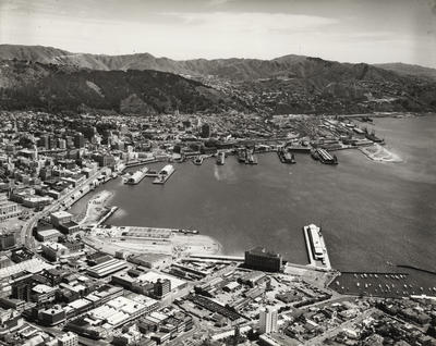
Collection of pictorial, manuscript, ephemeral and published material including photographic print reference albums, aviation logs related to MOTAT's Beech Kansan AT-11, New Zealand Aerial Mapping advertising ephemera, and sundry publications. Henry Piet Drury Van Asch established New Zealand Aerial Mapping Limited in 1936 to map New Zealand from air. The company operated out of Hastings for 78 years, extending operations to the wider Pacific region from 1944. This collection highlights operations between circa 1930 - 1980 with material that demonstrates aerial photography, laboratories, equipment, and the aerial fleet during this period in New Zealand.
Physical description
2 four-flap folders ; 36 cm + two outsize boxes + 1 outsize folder
Record level
Collection
Credit line
New Zealand Aerial Mapping Limited. 1930s-1980s. [New Zealand Aerial Mapping Limited collection], COL-2018-3. Walsh Memorial Library, The Museum of Transport and Technology (MOTAT).
![Aircraft [Beechcraft AT-11 Kansan ZK-AHO]; Beech Aircraft Corporation; New Zealand Aerial Mapping Limited; 1942](https://collection.motat.nz/records/images/medium/54153/220c319ae0475ddf270b2371b0374a9e90459e50.jpg)
Public comments
Be the first to comment on this object record.