[Hautope aerial diapositive]
Maker and role
New Zealand Aerial Mapping Limited, Photographer
Production date
23 Nov 1976
Object detail
Accession number
PHO-2020-9.1
Production period
Description
Aerial image on a film diapositive of Hautope Road, Tukituki River and surrounding area in Omakere, Hawkes Bay.
Image taken by New Zealand Aerial Mapping during an orienteering mapping flight in the Hawkes Bay.
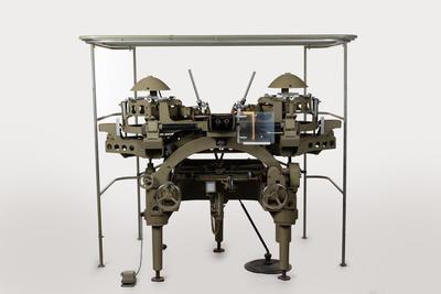
Diapositive held in right stereoplotter frame (or plate carrier) for photogrammetric mapping on a stereoplotter by New Zealand Aerial Mapping.
At time of donation diapositives held in a stereoplotter frame (plate carrier) for Wild A6 stereoplotter, which are also able to be used in a Wild A8 model.
On diapositive are circled in pencil 4 dams. Central cross marks control point.
Image taken during survey SN2922,at elevation: 23500; run number: K, image number 10. Scale 1 : 47000
Marks
388 Printed
2992 K/10 Hand-written
2992 K/10 Hand-written
Media/Materials
Physical description
1 diapositive : black and white ; 23 x 23.5 cm
Collection
Credit Line
New Zealand Aerial Mapping Limited. 23 Nov 1976. [Hautope aerial diapositive], PHO-2020-9.1. Walsh Memorial Library, The Museum of Transport and Technology (MOTAT).
Production place
Omakere
Central Hawkes Bay
Hawkes Bay
New Zealand
Central Hawkes Bay
Hawkes Bay
New Zealand
Current rights


![Gear Set [Wild Heerbrugg A8 725 Stereoplotter]; Wild Heerbrugg Limited](https://collection.motat.nz/records/images/medium/52889/ad13c59a62e04390dd23c6cc9dc11f0cac60a776.jpg)
![Gear Set [Wild Heerbrugg A8 725 Stereoplotter]; Wild Heerbrugg Limited](https://collection.motat.nz/records/images/medium/52885/3670a12ef8f1044450ad5f88667e119fda0f8aab.jpg)


Public comments
Be the first to comment on this object record.