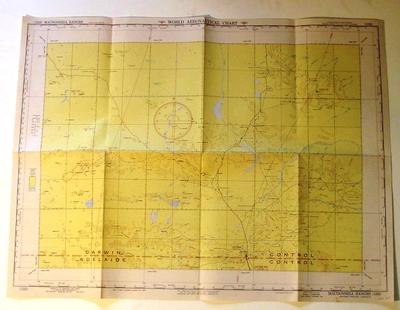
Map - Macdonnell Ranges, NT, Australia
Object detail
Accession number
2003.367
Description
Map - paper - World Aeronautical Chart. Macdonnell Ranges (1232) Northern Territory, Australia. Published by the Aeronautical Chart Service US Army Air Forces Washington D.C. Revised May 1947. Region Alice Springs. Aeronautical information printed on the back of the map.
Marks
WORLD AERONAUTICAL CHART / (1232) MACDONNELL RANGES / PUBLISHED BY THE AERONAUTICAL CHART SERVICE / U. S. ARMY AIR FORCES, WASHINGTON, D. C., / JUNE 1945 (SCS) Revised MAY 1947 (ACS) BASE NO. 3R / Lithographed by A.M.S., 9.47 341955 / Aero Overprint by ACS, 11-47 / S2000-E13000/400x600 / SCALE 1:1,000,000 / THIRD EDITION - NOVEMBER 1947 / MACDONNELL RANGES / NORTHERN TERRITORY, AUSTRALIA / (1232) Printed
Media/Materials
Credit Line
Map - Macdonnell Ranges, NT, Australia, 2003.367. The Museum of Transport and Technology (MOTAT).


Public comments
Be the first to comment on this object record.