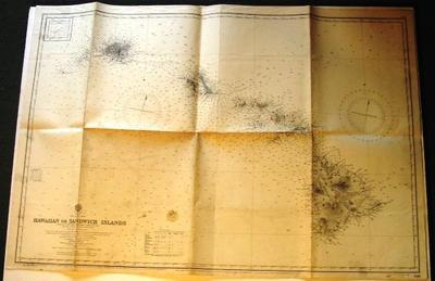
Map - Hawaii
Object detail
Accession number
2003.380
Description
Map - paper - Hawaiian or Sandwich Islands 1510. From the United States Government Charts to 1930 Nihoa from an Hawaiian Government Chart of 1885. The names of the islands engraved in hairline within brackets are the original names assigned by Captain Cook in 1779. Published at the Admiralty 9th April 1881 under the Superintendent of Captain E J Evans. R.N.CB. FRS Hydrographer. Last update 1941. Islands Hawaii, Maui, Molokai, Oahu, Kauai.
Marks
HYDROGRAPHIC OFFICE / Price Four Shillings / & Sixpence / NORTH PACIFIC OCEAN / HAWAIIAN OR SANDWICH ISLANDS / FROM THE UNITED STATES GOVERNMENT CHARTS TO 1930. / Nihoa from an Hawaiian Government Chart of 1885. / With corrections and additions to 1935. / London._Published at the Admiralty, 9th April, 1881; under the Superintendence of Captain F. J. Evans R.N: C.B:FRS. Hydrographer. / Crown Copyright Reserved / 1510 Printed
Media/Materials
Credit Line
Map - Hawaii, 2003.380. The Museum of Transport and Technology (MOTAT).


Public comments
Be the first to comment on this object record.